
Day 29: 180 Miles
Starting location: Pine Springs Campground, Guadalupe Mountains National Park, Texas – 22 degrees
Ending location: Oliver Lee Memorial State Park, Alamogordo, New Mexico – 60 degrees
Major Stops: None
Weather: Cloudy with some sun here and thereDays: 30 – 34 – Oliver Lee Memorial and around Alamogordo, New Mexico
Hikes: Dog Canyon (5.0 miles), Lawson Springs (1.5 miles) and the Old Road to El Paso (5.3 miles)
Other Major events: Dodge Dealer, Groceries, Propane and meeting a new friend
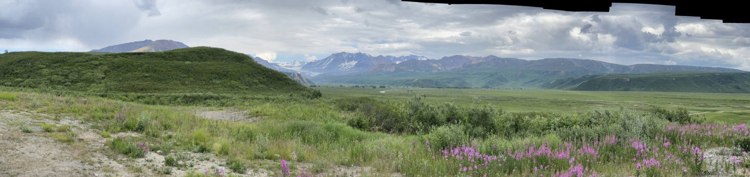
A cold crisp morning escorted us out of Guadalupe Mountain National Park. Since it had been such a cold stay, we were ready to head out. Our destination gave us a choice to either go south to El Paso or North through Carlsbad which would let us drive through some mountains. So, naturally, I chose the mountains with the distance about the same!
Once we got past Carlsbad, the terrain leveled out and became the most boring drive we’ve had yet. It was filled with unsightly oil and gas wells, and felt like driving through Gary Indiana without the old buildings. There were even pipes throwing off big flames to burn off the gas and the smell was terrible. Thankfully, the terrain finally started to transition and we entered the Lincoln National Forest.
Mountains and Brakes!


We kept seeing signs that said “No Commercial Trucks” over a certain weight. Then there was a schematic showing the elevation change from Cloudcroft (8,650 elevation) to Alamogordo (4,335 elevation). Hence we would drive a drop of over 4,300 feet! I saw that sign probably over ten times before we got to Cloudcroft. At Cloudcroft there was another stand-alone sign saying “6% grade over the next 16 miles“. I think they are serious.


I thought the brakes were not going to give me the error, but then in the last few miles, it went off as the grade got more intense. It did the same thing, when I stopped the vehicle and restarted it, the warning was gone. I decided to get it checked at the next Dodge dealer. Enough!
Oliver Lee Memorial State Park
After getting safely down the mountain and a few more miles south of town, we arrived at the park. I could see the campground from miles away, and thought, “I’m going to hate this. It’s so exposed in the middle of the desert.” But, when we got there, the scenery and backdrop was so breathtaking.


Naturally, on Monday we had to get the “work” done, so, off to the Dodge dealer we went first. They checked the fluids and did a visual inspection, and the brakes looked good. The Service Manager instructed me to drive right to a dealer if it happened again without shutting it off since they were not able to tell anymore without the warning light still on. Well, at least we know the fluids look good and it seems to be nothing but angle. After getting propane and groceries, we returned to the park and I started to write a blog post. We had cell service here!
The Hikes
I decided to tackle the biggest hike first. Dog Canyon has a 3,000 foot elevation change. Trying not to blow my knees, I decided we would only go as far as we could and then turn around. Based on the length of the trail, I estimate we did 2,000 feet of it. It was not until we started back that I knew what kind of treacherous hike I was on. Suddenly, I was trying to negotiate major rock scrambles along the edge of a cliff with a dog pulling me down the trail. Up was so much easier!


The next day we took a much shorter and less strenuous hike to Lawson Spring. This was mostly to stretch out my legs and keep us moving.


Making a New Friend
As we came back into the campground a lady stopped us and wondered if we could go for a hike with her. She was using the “Old Road to El Paso” which runs through the BLM land surrounding the campground for her training to backpack the Colorado trail (~500 miles). So, we arranged to hike together the next day, meeting up at 11am. She is not a morning person, so 11 was a compromise from noon. I know you are laughing at this, as I am such a morning person.
At the end of the conversation, it suddenly occurred to me that Nancy would probably hike me into the ground. So, I let her know that I hike pretty slowly. Of course, you had to see this coming, she told me she hiked fast to make up for lack of elevation in her training. I paraphrased Jay’s words, ‘we must hike our own hike’ and if it doesn’t work, no worries. So, we decided to give it a go.
Meeting precisely at 11am at the restrooms, we had a lovely hike through the desert along the gravel road to El Paso. There were a lot of ups and downs from the gullies formed by the runoff and enhanced by ATV traffic. Towards the end of the hike, Nancy graciously told me my pace was quite good for her.
Nancy shared a lot of backpacking tips on getting the pack weight down as we hiked. She will hike the Colorado trail in July of this coming year. I have another friend out there! Good luck on the hike, Nancy!
Me, I’m glad I have the RV! I don’t think I could ever get that pack weight down enough to through hike. And, oh by the way, Nancy did not want to do the Dog Canyon hike for fear she might hurt herself before her big hike. So, really, it was treacherous!
Loved the sunset! You’re using your lower gears in the mountains?
Thanks, Cindy!
Yes, I am using the lower gears. I actually have manual shift I can use, and the van itself automatically shifts down when descending rapidly. So, doing all I can to take the pressure off the brakes. In fact, the last time it went off, I wasn’t even using the brakes as the engine was doing all the work. That’s what also makes me think it’s the angle of the vehicle setting it off. I now look at run away truck lanes a little differently. 😘